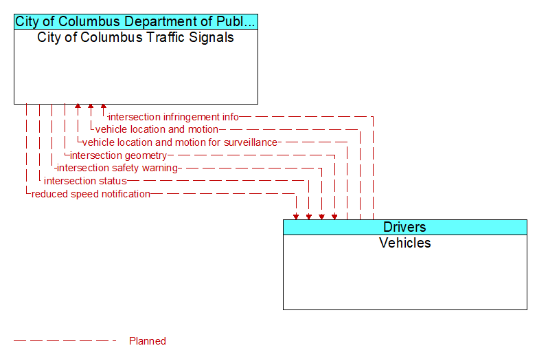
Interface: City of Columbus Traffic Signals - Vehicles
Architecture Flow Definitions
intersection geometry (Planned ) Applicable ITS Standards
The physical geometry of an intersection covering the location and width of each approaching lane, egress lane, and valid paths between approaches and egresses. This flow also defines the location of stop lines, cross walks, specific traffic law restrictions for the intersection (e.g., turning movement restrictions), and other elements that support calculation of a safe and legal vehicle path through the intersection.
intersection infringement info (Planned ) Applicable ITS Standards
Vehicle path information sent by a vehicle that is violating the stop bar at an intersection. This flow includes the vehicle's position, heading, speed, acceleration, transmission, steering–wheel angle, braking status, size information and trajectory.
intersection safety warning (Planned ) Applicable ITS Standards
A warning of an imminent unsafe vehicle infringement at an intersection that may endanger other vehicles or pedestrians. This allows vehicles approaching the intersection to be warned in the event of an imminent red light or stop sign violation or potential infringement on an occupied crosswalk. All connected vehicles at the intersection receive the warning, including both the infringing vehicle and other vehicles at or near the intersection.
intersection status (Planned ) Applicable ITS Standards
Current signal phase and timing information for all lanes at a signalized intersection. This flow identifies active lanes and lanes that are being stopped and specifies the length of time that the current state will persist for each lane. It also identifies signal priority and preemption status and pedestrian crossing status information where applicable.
reduced speed notification (Planned ) Applicable ITS Standards
Reduced speed zone information provided to passing vehicles. This flow provides the reduced speed limit, the location and extent of the reduced speed zone, and associated warning information.
vehicle location and motion (Planned ) Applicable ITS Standards
Data describing the vehicle's position, heading, speed, acceleration, transmission, steering wheel angle, braking status, size information, and trajectory.
vehicle location and motion for surveillance (Planned ) Applicable ITS Standards
Data describing the vehicle's position, heading, speed, acceleration, transmission, steering wheel angle, braking status, size information, and trajectory. This flow represents monitoring of basic safety data ('vehicle location and motion') broadcast by passing connected vehicles for use in vehicle detection and traffic monitoring applications.